Facing what appears to be intensifying weather events, scientists have come up with new tools to predict, in order to prevent, flood destruction. To this end, the Aquanty model Phase II is to be completed by next summer and hopefully, have application for Virden and the surrounding municipality.
Town of Virden representative to the Assiniboine River Basin Initiative (ARBI) Terry Johnson attended the Jul. 11 Council Meeting to report on the June meeting and tour in Russell and area.
The current state of the Aquanty model was presented on the morning of Jun. 22 and Johnson said, “Each time I see this, I’m always kind of amazed at what this thing may be able to do for agriculture.”
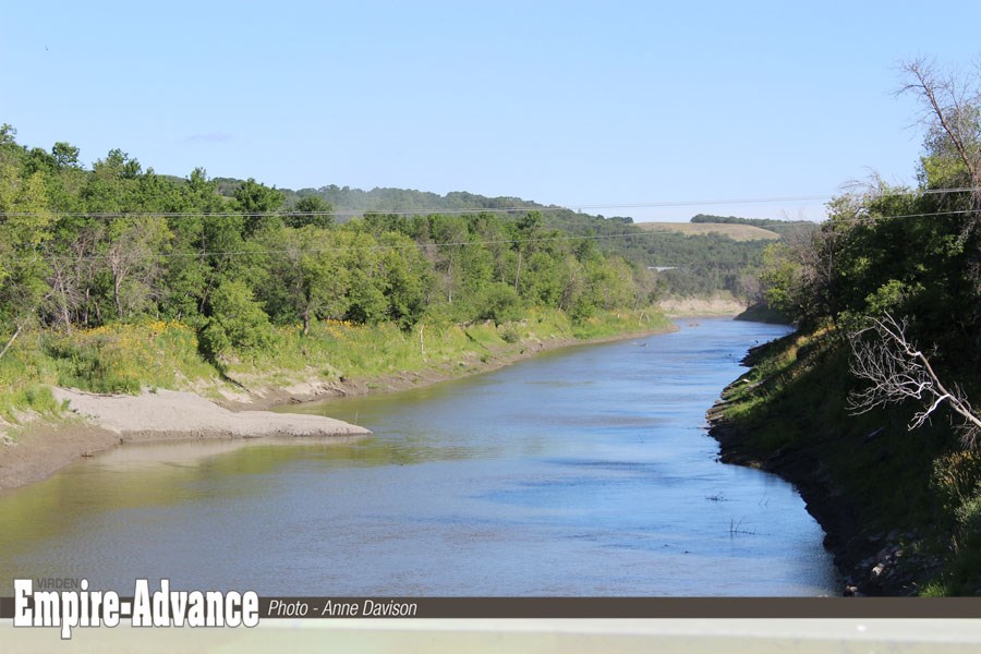
Rural residences, towns and cities rely on decision makers to act when high water rushes toward them. Aquanty modeling is a digital, predictive tool that can read soil types, surface and subsurface landscape factoring in elevation, and precipitation, to give councils predictive information.
The ARBI tour included other aspects of conservation.
“We jumped on a bus and toured the area below the Shellmouth Dam, the Dropmore area, and had a look at some cattle operations and how they are working in a holistic manner with nature.”
Johnson noted that agriculture has continued to change to cooperate with the environment. He saw firsthand, the effects of the heavy grasses planted along creek beds, “to slow water up to allow it to percolate into the land.
“As well, they are adjusting calving seasons...the cows are more in tune with the deer and buffalo, which is a June calving cycle. All for the good.”
He spoke of a water control structure on Fouillard’s property - a very small weir, putting water back and releasing in as needed - part of “simple solutions for complex issues, flood and drought proofing in concert”.
As a former farmer in the McAuley area Johnson remembers the dry times as well as recent flood years.
“All these structures that have been quietly put in place by farmers, generally with the CDs - when you look at them, and at what they do around the area for the habitat, for the birds and all the critters, you’ve got a tool that basically flood proofs, holding water back. And, in dry cycles it can be used to keep things going.”
The tour wound up at Shellmouth Dam where they saw a fish ladder in operation.
“Eugen Costura gave us a very good history lesson on why the dam was constructed in concert with the floodway around Winnipeg...and how, in today’s world, it is used as a water management tool in concert with recreational needs.”
The evening wrapped up with a Q&A of the IBM technologists (also on the tour) regarding the Aquanty program.
A technologist explained the use of programmable 3-D goggles in a ‘what if’ model (like a five-inch rain on graduation night, for example). Using Aquanty, the information can help even local leaders know what is required.Aquanty Phase II would provide just such capabilities.
Ryan Canart (Upper Assiniboine River Conservation District) has filled out the preliminary forms [for Aquanty Phase II funding] with Agriculture Canada and the response has been encouraging,” stated Johnson. He added, there would be need for a local steering committee (RM and Virden) and possibly some small amount of funding from municipal governments.
In this ongoing process, Johnson says they are pushing for the water on thesouth side of Highway One to be included in the Aquanty study, “since both creeks have adversely affected Virden”.
Johnson told Council, “We’re getting good value, I believe, for tax dollars you spend supporting your CDs.
ARBI business
Executive Director for ARBI Wanda McFadden and Chair of the Board Dr. Allan Preston continue to seek long term funding for ARBI.
There was discussion regarding a high resolution Lidar which can help Aquanty modelling accuracy. Johnson said, “Instead of looking at stuff on, maybe, a one sq. ft. basis as far as topographics go, they’re going to go down to a quarter inch. It’s a pretty powerful tool.”
Johnson also reported that ARBI received a presentation from the newly formed (Nov. 2016) Quill Lakes Watershed Association regarding problems with the basin flooding agricultural land and washing away infrastructure.
Preliminary projects to get rid of Quill Lakes’ highly saline water include drilling 20 injection wells, 2500-3000 feet deep to inject the water into underground aquifers.
“I think people around the table are saying, ‘Humm, I wonder about that’, but, they’re doing it and they have money to do it,” stated Johnson to Council.
Quill Lakes may also send waterinto the Qu’Appelle water shed. “That’s going to come by us,” explained Johnson, “and it is huge tracts of land holding water. So, those are the types of things that we’re keeping an eye on.”
Following the report to council, Mayor Jeff McConnell likened the Quill Lakes to Devils Lake in North Dakota – also a closed lake, saline basin, with no outflow. Through an agreement with Manitoba, including means to filter the water, it that was eventually allowed to overflow into the Red River watershed. McConnell noted that at that time there was concern for contamination, from “an ecosystem that’s never been in the Red River”.
Johnson’s report says the government of Saskatchewan has not put funding or representation towards ARBI. Disappointing, to be sure, but we remain hopeful,” he commented.”
The Assiniboine River Basin Initiative AGM is slated for Regina, February 2018. Johnson asked the Town of Virden to find an alternate for the annual meeting, in his absence.


