Talk about the weather doesn’t seem as boring as usual. There could be a couple of reasons for this. First, absolutely anything beats a discussion of our current pandemic obsession, and second, this week’s weather is nothing short of bizarre.
The beginning of this week brought the warmest weather so far this season, as temperatures rose close to 30 degrees. A strong southerly flow delivered this welcome warmth in what had been a backward (cold and dry) spring, to the Westman region. However, hopes of much needed rain got delayed once again.
The wind and dry conditions contributed to several serious wildfires, most recently including a big one in the Carberry area that burned 37,000 acres, the Hamiota fire on Tuesday, and last week’s fire in the Assiniboine Valley north of Miniota.
We often look west to see what weather is approaching and current modeling shows an area of snow developing in southern Alberta overnight. Yes, snow. The snow zone is forecast to spread east into Saskatchewan over the next few days with close to a foot of snow expected in spots near Swift Current. Further east, in southeast Saskatchewan and southwest Manitoba we should escape the snow and can hope for 1-3 inches of rain.
Does this indicate a change to the current dry cycle?
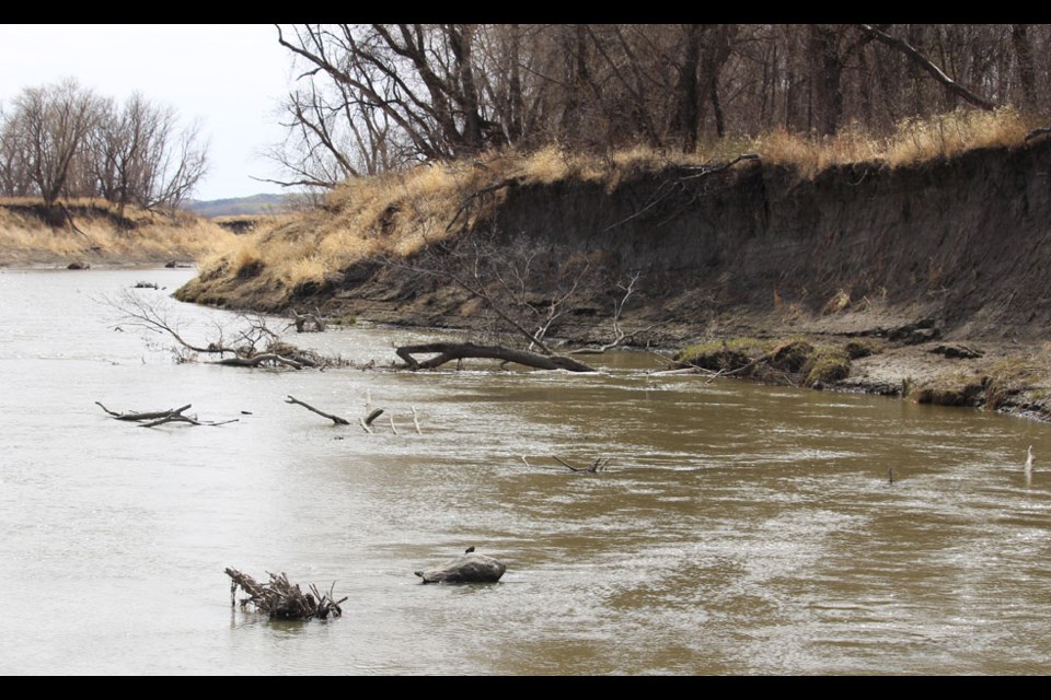
Shellmouth Dam was lowered this March, adding flow to the Assiniboine. It’s a common spring practice. Lake of the Prairies is now sitting at two feet below target level. Yet, in the Virden area the Assiniboine River has become a muddy little creek, displaying bare banks, ravaged in past 500-year flood events that turned the whole Miniota valley into a vast lake.
It’s too soon to tell if the drought will break, but areas of southern Manitoba facing water shortages hope so. The city of Morden has cancelled use of their spray park for the summer, and will not irrigate parks and ball diamonds.
The long weekend will feel very different from the early days of this week. A cold front moving through on Wednesday will begin a much cooler, unsettled period, with successive bands of wet weather moving through. The whole business clears out just in time for back-to-work Tuesday.
To add interest to this scenario we see that the clear, cold, dry Arctic air will arrive at the same time as the May Super Moon and a total Lunar Eclipse. This looks like a recipe for frost, and some models agree.
But this is just our own little corner of the world. Elsewhere in North America, the coastline of the Gulf of Mexico is expecting up to eight inches of rain within the next few days.


